Aegina, 30/08/2021.
This workshop was organized during the 2021 mission of the Aigina Harbour city project. The objective was to test the U2 services and more specifically the function of the calibration of the photos in services U2 as derived by different underwater cameras.
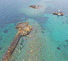
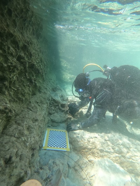
During this workshop, a laminated chess-board was attached to a plexiglass tablet and was placed in the underwater environment inside the trench TR5 of the archaeological excavation located at the fortification wall of the entrance of the ancient naval harbour of Aigina dating to the 5th c. BC. The chessboard was photographed by underwater archaeologists, PhD and Master students of MoMArch (Master of Maritime and Coastal Archaeology) using three different underwater cameras with different calibration parameters on the U2 service. The cameras included a wide-angle GoPro HERO 9 Black, a Nikon D5 and a Sony DSC-RX100.
A series of the results were tested immediately on the field site; other datasets were tested after our return to the CNRS Laboratory of AMU in September and October 2021, and finally a workshop was organised in November 2021 for the testing of the service from the two promotions of the Master of Maritime and Coastal Archaeology (MoMArch). In this workshop external colleagues were invited, as well as underwater archaeologists from CNRS Laboratories and Museum curators (National Museum of Denmark).
The following figures show the location of the underwater trial and underwater photography of the chessboard inside the archaeological excavation trench at the entrance of the naval harbour of the ancient harbour-city of Aigina dated at the 5th c. BC. @EUA, Ministry of Culture / Aix-Marseille Université – CCJ – MoMArch / EFA, photo drone: J. Anbar, AMU-NKUA 2021, photo underwater: K. Baika (CCJ- AMU).


