Online, 14/02/21
The Panhellenic Association of Graduate Engineers in Geoinformatics and Topography carried out the teleGeotopina webinars with presentations of speakers related to the science of Geo-informatics and its branches, including NEANIAS. The event was held in Greek.
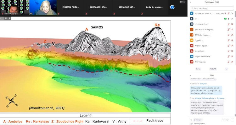
NEANIAS project participated and the Underwater Services for the automated processing of marine data were presented during the webinar, that had more than 850 registrations.
Με επιτυχίαπραγματοποιήθηκε από τον Πανελλήνιο Σύλλογο Πτυχιούχων Μηχανικών Γεωπληροφορικής και Τοπογραφίας, η 20η ΤηλεΓΕΩΤΟΠΟσυνάντηση (webinar), με επίσημο καλεσμένο τον Πρόεδρο του Τμήματος Γεωλογίας και Γεωπεριβάλλοντος, ΕΚΠΑ και Πρόεδρο του Οργανισμού Αντισεισμικού Σχεδιασμού και Προστασίας, τη Κυριακή 14 Φεβρουαρίου 2021.
More details at sgeotopo.gr.