Online, 20/04/2021.
Sensing, Mapping and Reconstruction of the Underwater Environment is a demanding task still possessing a great amount of scientific and technological challenges; NEANIAS team presented their underwater services in a dedicated webinar.
The main active (e.g. multibeam echosounders) and passive (e.g. RGB camera) sensors deployed on supporting ships, ROVs, AUVs producing a significant amount of data (images and point clouds) towards addressing mainly the critical tasks of (i) bathymetry mapping, (ii) seafloor mosaicking and (iii) seabed classification, targeting a vast variety of application fields and communities like submarine archaeology, geology, oil and gas, energy power cables, pipelines, and others.
Proposed NEANIAS Solution: Further develop, optimize and validate existing software solutions towards addressing the diverse user communities needs through the deployment of underwater bathymetry mapping, mosaicking and seabed classification services at EOSC.
Within the Blue Research and Innovation Days event, the NEANIAS team presented the services for the underwater environment offered by the project, which include the following services:
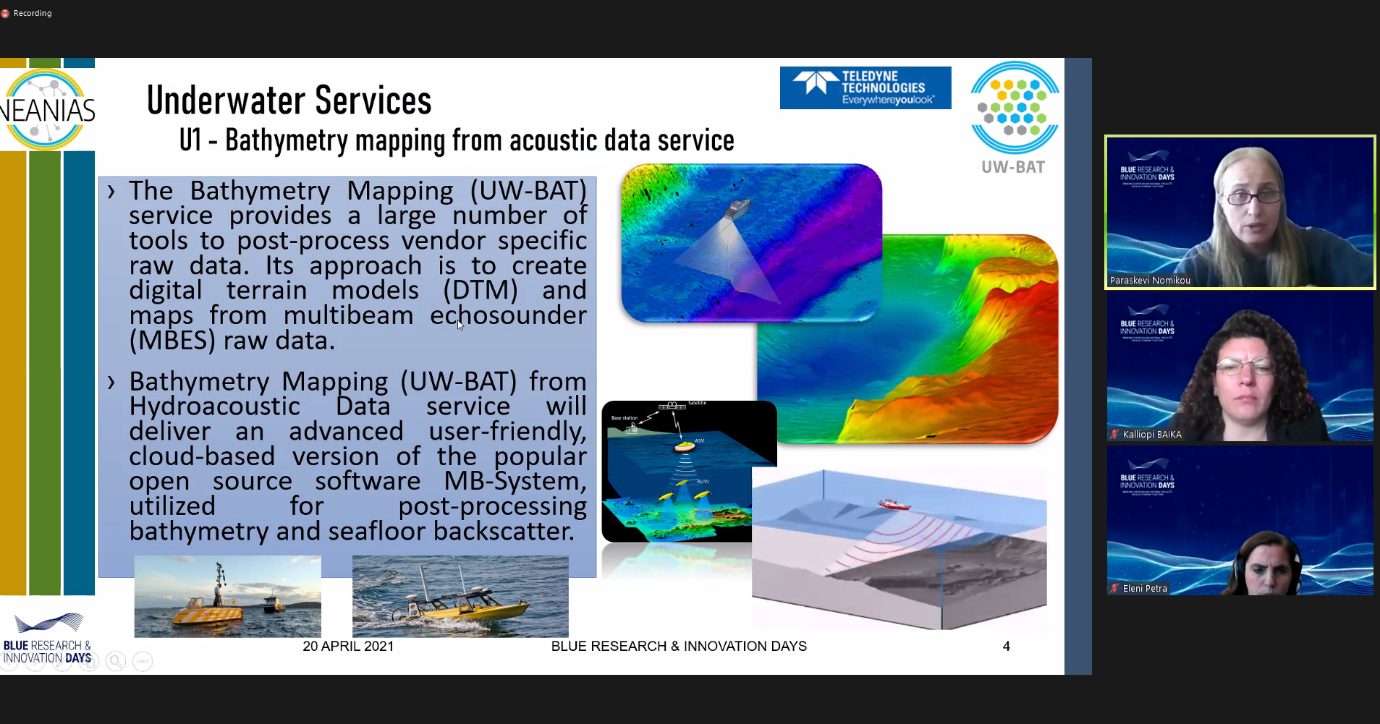
- U1 - Bathymetry mapping from acoustic data service
- The Bathymetry Mapping (UW-BAT) service provides a large number of tools to post-process vendor specific raw data. Its approach is to create digital terrain models (DTM) and maps from multibeam echosounder (MBES) raw data.
- Bathymetry Mapping (UW-BAT) from Hydroacoustic Data service will deliver an advanced user-friendly, cloud-based version of the popular open source software MB-System, utilized for post-processing bathymetry and seafloor backscatter.
- U2 - Seafloor mosaicking from optical data service
- The Seafloor Mosaicing (UW-MOS), deals with optical mapping in underwater environments. It provides a set of sub services related to mapping using images, including camera calibration, image quality check, 2D mosaicing and 3D reconstruction.
- The Seafloor Mosaicing (UW-MOS) from Optical Data service aims to provide an operational solution for large area representation (in the order of tens of thousands of images) of the, predominantly flat, seafloor also addressing visibility limitations from the underwater medium.
- U3 - Seabed Classification from multispectral, multibeam data
- The Seabed Classification (UW-MM) from Multispectral, Multibeam Data service will deliver a user-friendly cloud-based solution integrating cutting-edge machine learning frameworks for mapping several seabed classes, validated for archaeological, geo-hazards, energy, and other applications.